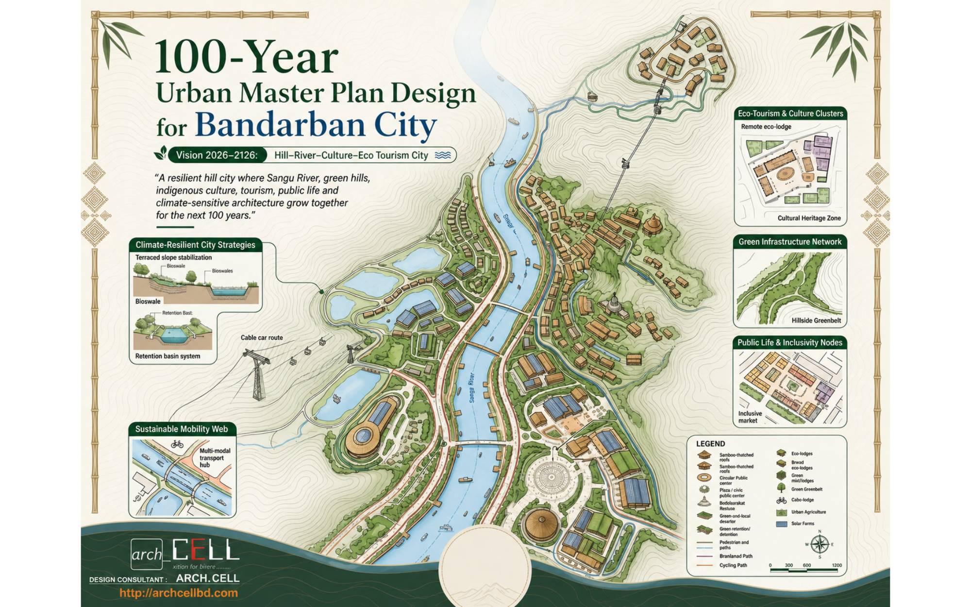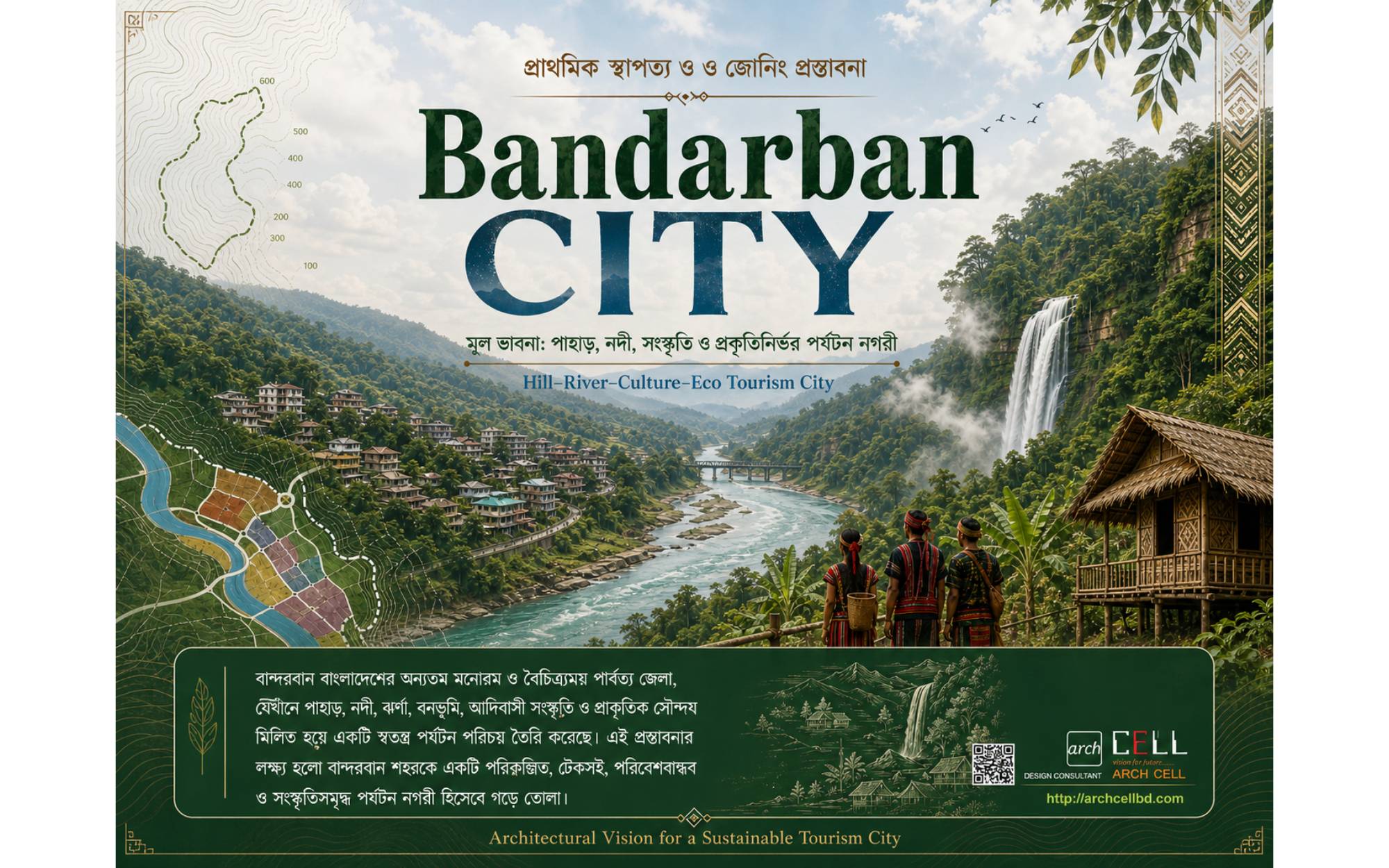
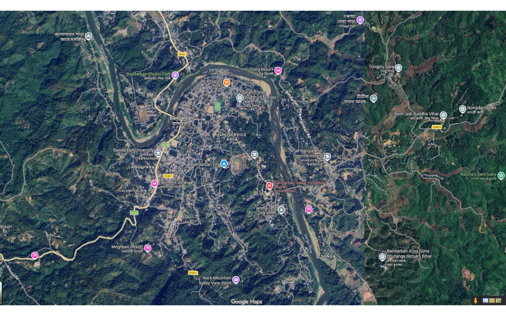
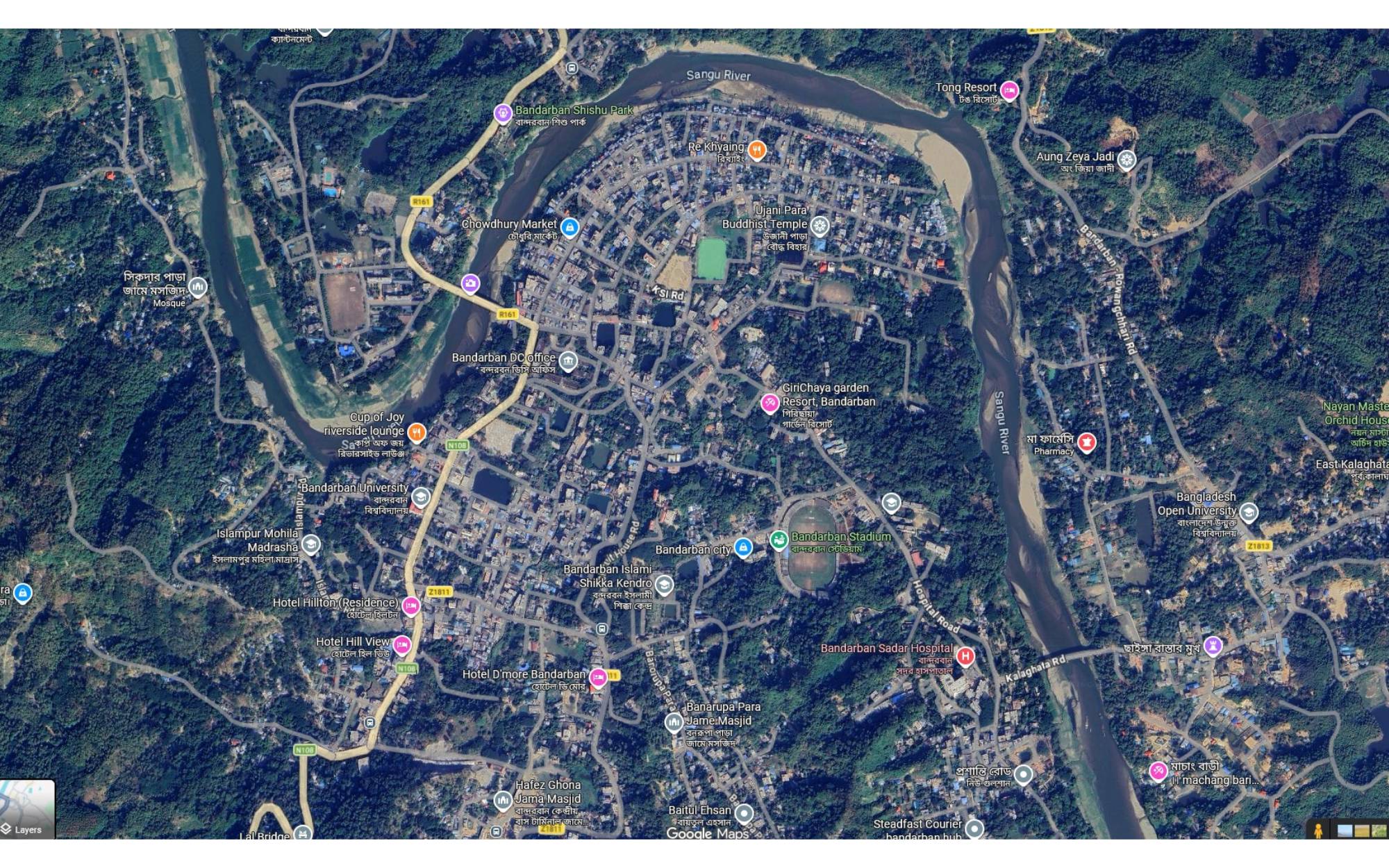
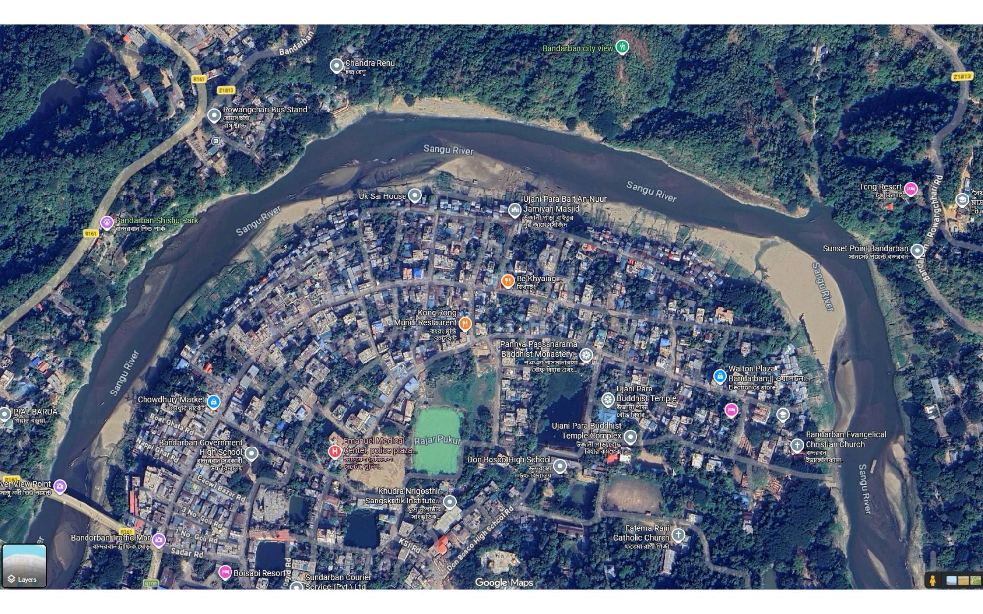
Bandarban is a unique hill city where mountains, the Sangu River, forests, indigenous culture and tourism form a strong natural identity. A climate-responsive urban design for Bandarban should not follow a flat-land city model. It should grow with the landform, protect the hills, restore water systems, reduce landslide risk, and create a sustainable eco-tourism-based urban environment.
To develop Bandarban as a resilient, nature-based hill city where urban growth respects hills, rivers, forests, water sources, cultural heritage and community life.
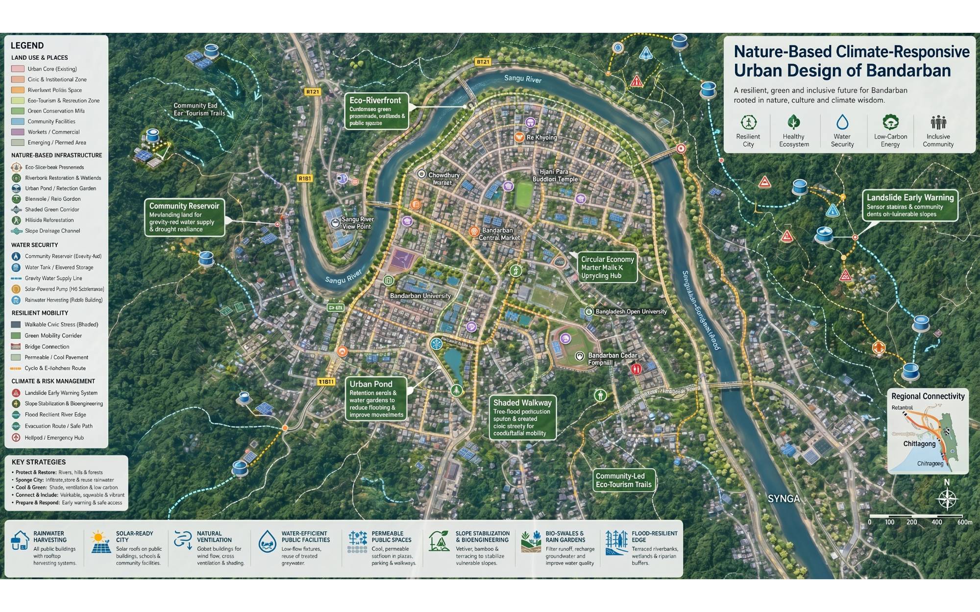
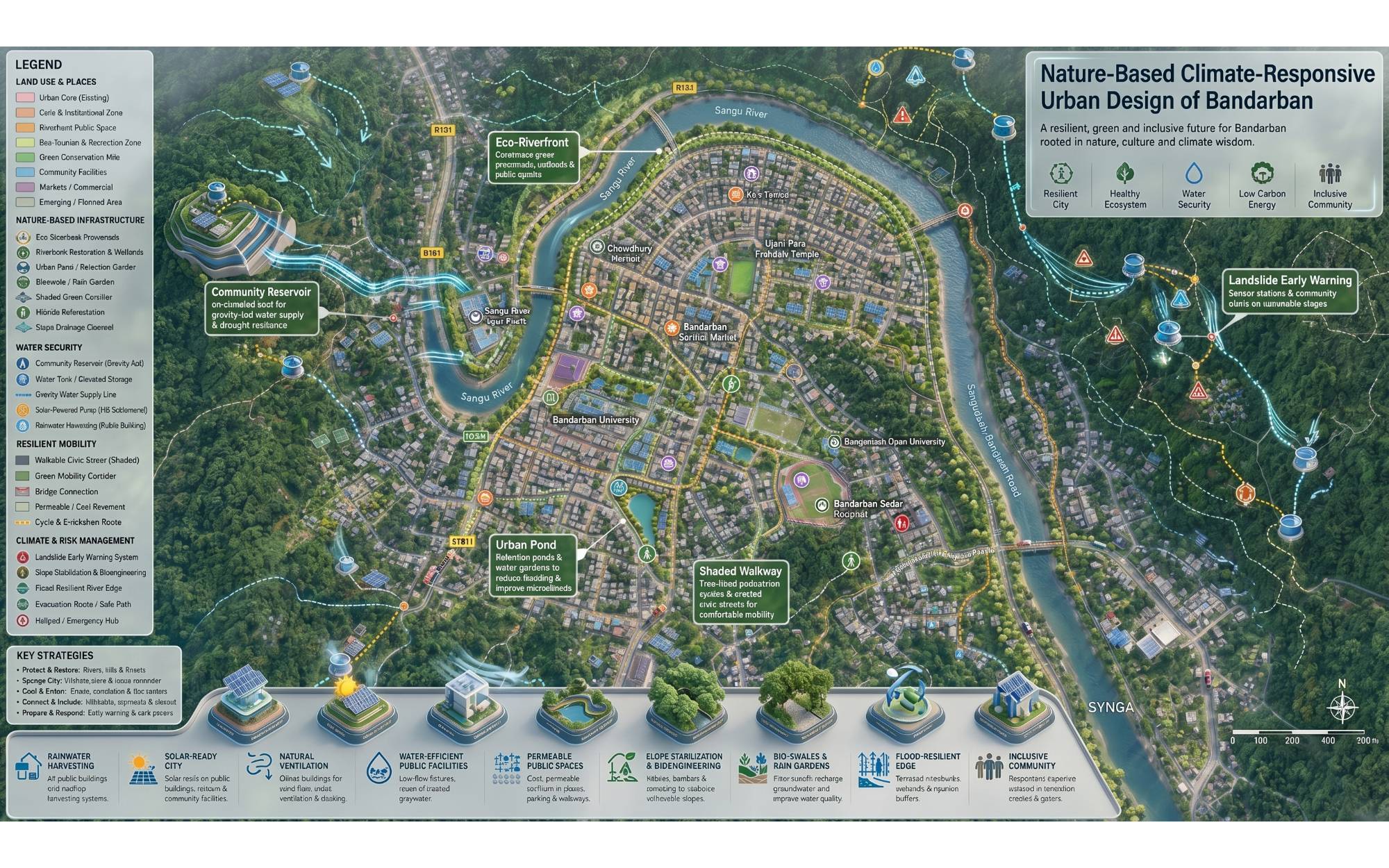
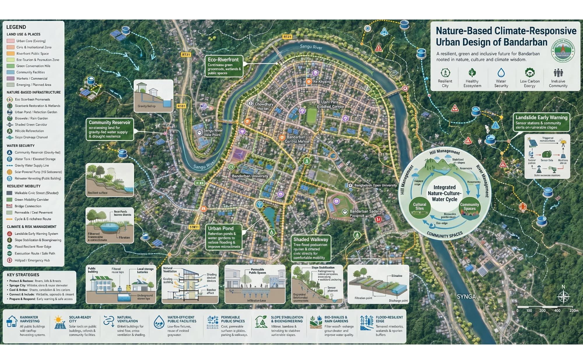
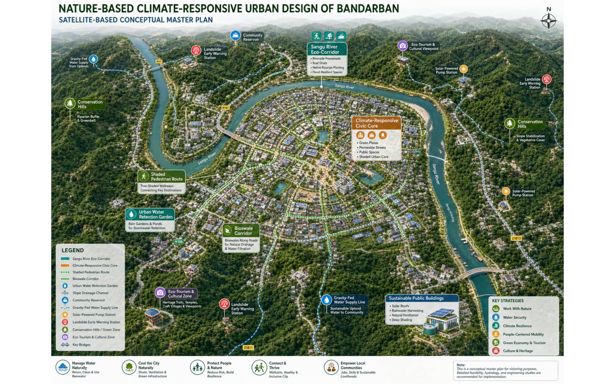
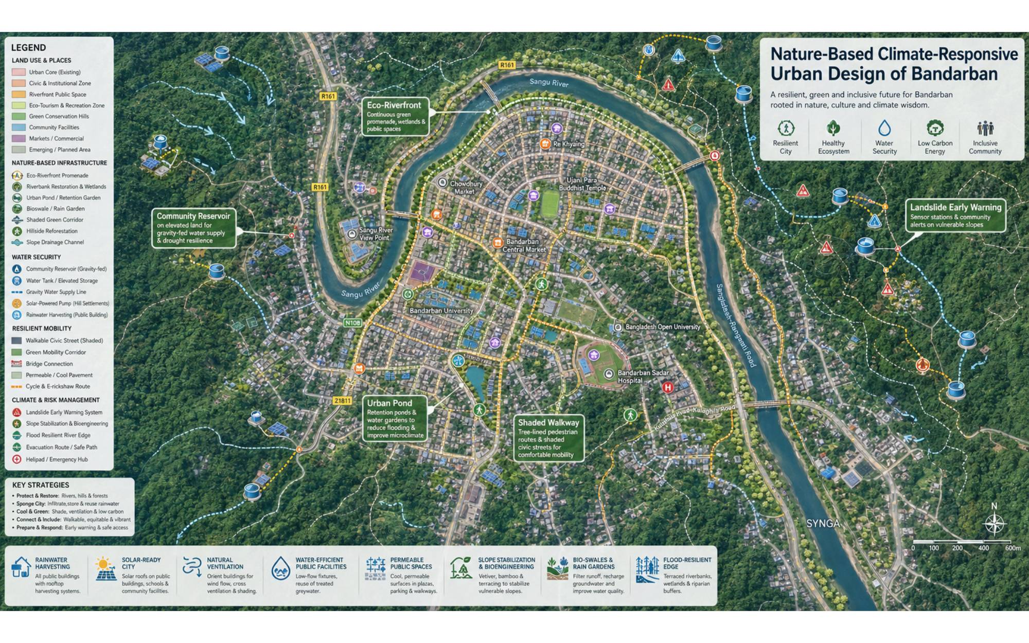
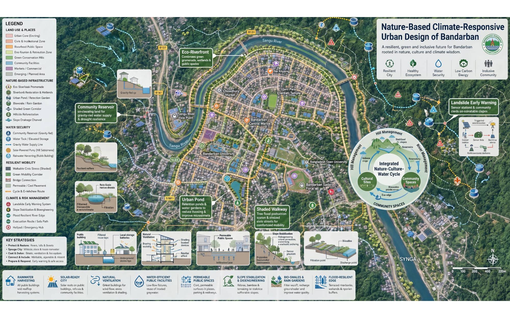
The main concept is to design the city as a “Nature-Based Climate-Responsive Hill Urban Settlement.”
This means roads, buildings, public spaces and tourism facilities should be planned according to the natural terrain, rainfall pattern, river system and ecological sensitivity of Bandarban.
The design should focus on:
Hills as natural structure
Urban development should follow contours and avoid risky hill cutting.
Sangu River as urban lifeline
The riverfront should be protected, restored and used as a public ecological corridor.
Forests as climate buffer
Existing green areas and hill vegetation should be conserved to reduce heat, erosion and landslide risk.
Water as a shared resource
Rainwater harvesting, community reservoirs and gravity-fed water systems should be integrated into urban planning.
Culture as identity
Indigenous architecture, local materials, crafts and cultural spaces should guide the city’s visual character.
Bandarban faces several climate and environmental challenges:
Heavy rainfall during monsoon
Landslide risk due to hill cutting and weak slope management
Water scarcity in remote hill settlements during dry season
Flash flooding and drainage problems
Soil erosion along slopes and roads
Unplanned tourism pressure
Loss of green cover and natural water sources
River pollution and encroachment along the Sangu River
A nature-based design approach can reduce these risks by using natural systems instead of depending only on hard engineering.
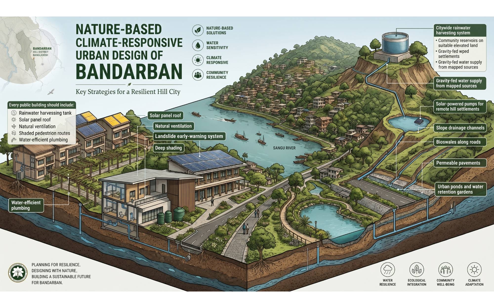
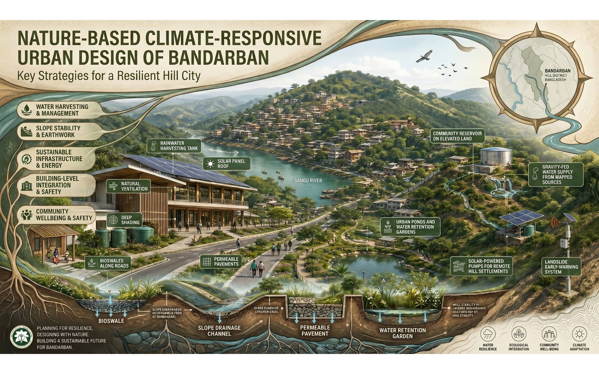
New roads, walkways, buildings and public spaces should follow the natural contour lines of the hills. This will reduce unnecessary hill cutting and protect the slope stability.
Design recommendations:
Roads should follow the natural terrain
Buildings should be placed on stable terraces
Steep slopes should remain green and protected
Retaining walls should be combined with vegetation
Large-scale earth cutting should be avoided
Hilltop areas should be preserved as green viewpoints and public spaces
The Sangu River should become the main natural spine of Bandarban city. Instead of treating the river only as a water body, it should be developed as a riverfront public and ecological corridor.
Proposed elements:
Riverfront walking promenade
Native tree plantation along the riverbank
Flood-resilient public seating areas
Eco-parks and river-view plazas
Pollution control and waste collection points
Small boat landing areas for tourism
Bioswale and rain garden systems near the river edge
Protection of natural riverbank vegetation
The riverfront should remain soft, green and permeable rather than fully concretized.
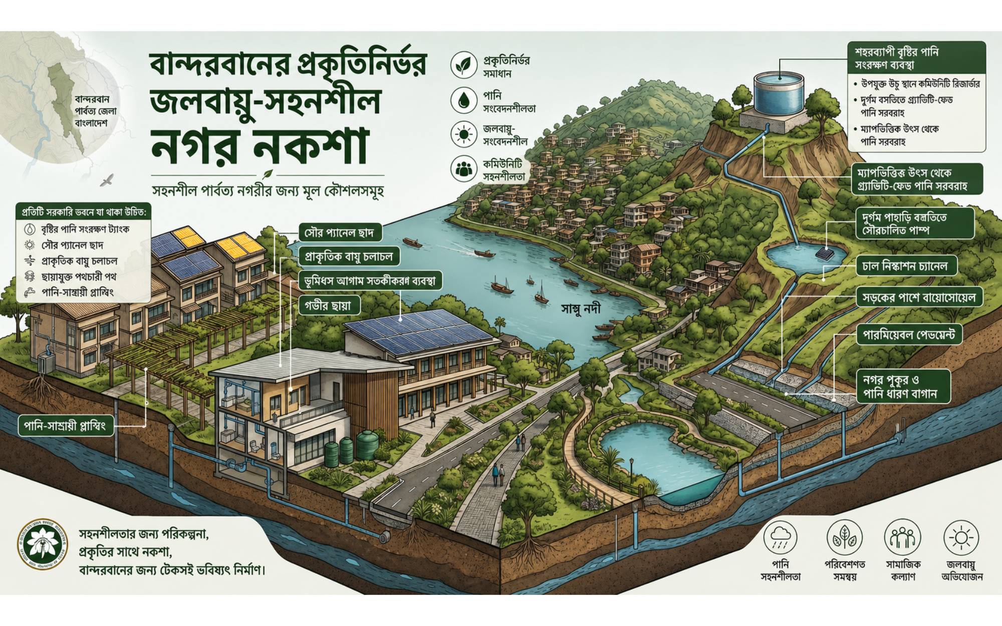
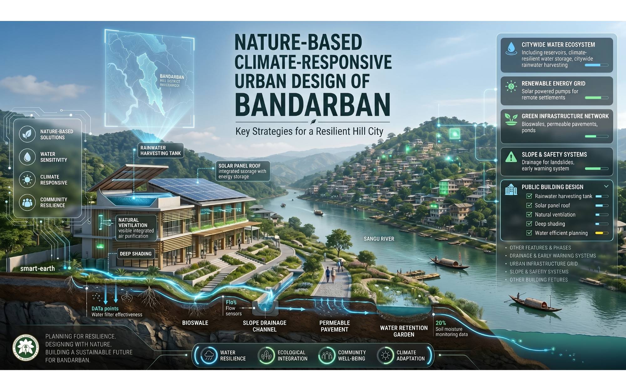
Water crisis is a major issue in hill areas. Bandarban needs a citywide water-sensitive design approach.
Proposed systems:
Rooftop rainwater harvesting in public buildings
Community water reservoirs on suitable elevated land
Gravity-fed water supply from mapped springs and streams
Solar-powered pumps for remote settlements
Rainwater storage tanks near schools, markets and tourist zones
Recharge ponds and small check dams
GIS-based mapping of water sources, settlements and elevation
This approach can reduce dry-season water scarcity and improve long-term water security.
Landslide-sensitive areas should be treated as ecological protection zones.
Design measures:
No construction on high-risk steep slopes
Slope stabilization with deep-rooted native vegetation
Terraced plantation along vulnerable hillsides
Bio-engineering with bamboo, vetiver grass and local shrubs
Controlled surface drainage channels
Early warning signage in risky areas
Hill-cutting control policy
Relocation of vulnerable structures from dangerous slopes
Nature-based slope protection is more suitable for Bandarban than heavy concrete treatment alone.
Bandarban should be planned as a pedestrian-friendly hill city with shaded walkways, small public transport routes and scenic tourist trails.
Proposed mobility system:
Contour-following pedestrian walkways
Shaded footpaths using native trees
Tourist walking trails connecting viewpoints
Cycle-friendly routes in suitable flat areas
Electric shuttle service for tourist zones
Small parking zones at city edges
Pedestrian bridges over drainage channels and streams
Safe steps and ramps in steep urban areas
This will reduce traffic pressure and create a healthier urban environment.
Buildings in Bandarban should respond to hot-humid climate, heavy rainfall and hill terrain.
Architectural guidelines:
Elevated buildings on stilts where suitable
Sloped roofs for heavy rainfall
Wide roof overhangs and shaded verandas
Cross ventilation through openings
Use of bamboo, timber, brick, stone and local materials
Rainwater collection from roofs
Solar panels on suitable rooftops
Buildings arranged according to wind direction and views
Low-rise development following hill character
Architecture should not dominate the landscape; it should blend with hills, trees and local culture.
Along the Sangu River with promenade, public plazas, native plantation, boat landing, cultural decks and river-view seating.
Existing hill settlements upgraded with safe access roads, drainage, water supply, sanitation and slope protection.
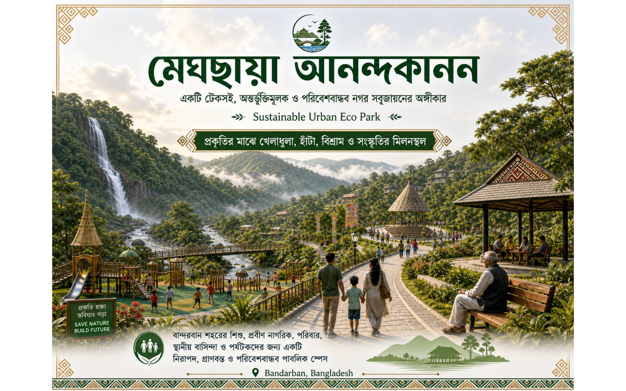
Tourism areas planned with controlled development, viewpoint decks, eco-lodges, walking trails and waste management.
Forests, steep slopes, springs and ecologically sensitive areas protected from construction.
Town center with public buildings, cultural plaza, indigenous craft market, public seating and pedestrian-friendly streets.
Reservoirs, rainwater harvesting structures, recharge ponds and gravity-fed water supply networks.
Rainwater harvesting network
Community reservoirs
Sangu Riverfront ecological park
Native tree plantation corridors
Hill slope protection landscape
Climate-responsive public buildings
Walkable urban trails
Eco-tourism viewpoints
Waste management and recycling points
Permeable paving and bioswales
Solar lighting along streets and parks
Cultural plaza and indigenous craft zone
Water-sensitive drainage system
Urban agriculture and community gardens
The landscape design should use local and climate-resilient plant species. Native trees help control erosion, improve biodiversity, reduce heat and stabilize slopes.
Suggested planting types:
Deep-rooted trees for slope stability
Bamboo and vetiver for erosion control
Shade trees along walkways
Fruit trees near community spaces
Riparian plants along Sangu River
Flowering trees for tourism streetscape
Medicinal and indigenous plant gardens in public parks
A climate-resilient hill city
Reduced landslide and erosion risk
Improved water security in dry season
Protected Sangu River and natural drainage
Stronger eco-tourism identity
Cleaner and greener public spaces
Safer hill settlements
Better pedestrian and tourist experience
Preservation of indigenous culture and landscape identity
Long-term sustainable urban growth
The future urban design of Bandarban should be guided by nature, not imposed against it. The hills, Sangu River, forests, rainfall, water sources and cultural diversity are the main assets of the city. A nature-based climate-responsive design can transform Bandarban into a resilient, beautiful and sustainable hill city where people, tourism, ecology and culture grow together.
Have a question? Chat with us on WhatsApp and we'll get back to you shortly.